
05-11-2006, 12:14 PM
|
|
Addicted Ledgie
|
|
Join Date: May 2005
Location: Minneapolis Minnesota
Posts: 13,872
|
|
Quote:
|
Originally Posted by David
You can check out some of the resources online. There is even some computer modeling for the 1700 quake & tsunami as well as for a hypothetical future event from the same fault.
http://walrus.wr.usgs.gov/tsunami/stoch_low.html
http://wrgis.wr.usgs.gov/open-file/of03-13/
There are speculative studies of the 1700 quake & tsunami. It would have affected shorelines from California, Oregon & Washington to Canada, Alaska, the Aleutian Islands, & around the Pacific rim, including Japan, the Kuril Islands in Russia, & islands like Hawaii.
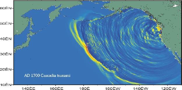
^This is a computer image created by a Japanese seismologist. It shows the tsunami six hours after it was created.
A Cascadia tsunami would probably be the worst in British Columbia & Washington. Remember how the tsunami in 2004 was the worst at Aceh, the shores closest to the quake? |
Thank you. I'll check that out! |









 Threaded Mode
